
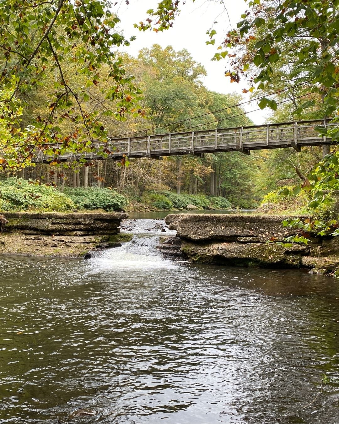
View the Savage River from a Unique Perspective
The bridge over the lake on rt. 219. The bridge on Glandale Road. The Casselman bridge. There is no shortage of bridges in the Deep Creek Lake area, and the average weekend visitor will cross over them in their travels to reach a desired destination.
There are a few bridges in the area, however, that you could argue are the destination and not a means to get there. The twin pedestrian bridges over the Savage River are not particularly easy to find, but they certainly are a destination worth exploring.
While standing on one of these bridges, named the Garrett and Allegany Bridges, you are immersed in the serenity and beauty of the forest. There is no high-traffic road, or even a parking lot, with vehicular noise nearby. You will not hear a cell phone ring because there is no cell service. It’s blissfully quiet, and while it is a picture-perfect moment, what is immediately notable is the effort that went into constructing the bridge, and you wonder why, exactly, the bridge was built. To put it simply, you are standing in a location that will forever hold its place in the history of white water rapids.
The Savage River flows through Savage River State Forest in which a dam was built in 1951. Controlled water releases from that dam create white water rapids that are highly sought after. These rapids require such technical skill that the Savage River became the first site in the United States to host the International Canoe Federation (ICF) Canoe Slalom World Championships. Unlike modern concrete channels, the “course” was a .85-mile stretch of the natural river, demanding immense technical skill to navigate its steep drops and continuous Class III-IV rapids.
With a large-scale event such as the ICF World Championships came the need for a way to turn the remote part of the forest into an area that competitors, reporters, coaches and fans could access. Temporary roads, grandstands and specialized access points were constructed along the riverbanks to allow fans to view the action in the rugged terrain without
compromising the protected local ecology. Spectator viewing areas were erected along both sides of the river to provide fans with sightlines to the racing action. While the pedestrian suspension bridges allowed spectators to move safely across the
river, it also served as a landmark near the end of the course and were an eyeline for competitors as they approached the finish line.
Constructing the pedestrian bridges was no easy task. First, no intermediate supports were permitted to be used, as they would impede the whitewater course, which meant cables were anchored into the bedrock. Additionally, those who were building the bridges were not permitted to enter the water, so as not to pollute it. It was the Maryland Army National Guard that originally constructed the bridges. In the 1988 annual report of the Maryland National Guard, several entries were included about the construction of the bridges. “The highlight of 1988 was our support of the Maryland International Canoe/Kayak Races on the Savage River in Western Maryland. As you know, we built two pedestrian suspension bridges and a boardwalk. Working closely with the Maryland Department of Natural Resources and the race committee headed by State Senator John N. Bambacus, we accomplished two major objectives: we helped our fellow citizens by enhancing tourism in Western Maryland and provided excellent training for the 121st Engineer Battalion.
While there are not many photographs of the temporary structures built for the ICF event, you can catch a glimpse in the video footage that remains. A video hosted on YouTube called “NBC Sports Coverage 89 Worlds Savage River Maryland provided by dale briggs footage” captures athletes running the course, but also spans the area enough to see the pedestrian bridge. The ongoing upkeep, such as inspecting the decking, tightening hardware, and ensuring safety for hikers and paddlers, is now integrated into the Maryland Park Service’s routine maintenance schedule for state forest trails and public access points.
If you are intrigued enough to seek out the bridges, getting specific directions to the location isn’t as easy as entering the destination into your phone. Locals may say it is, but it feels more like a bit of a scavenger hunt to find the bridges. You can use the GPS coordinates for one of the bridges: 39.501343 N 79.108957 W. If you look at a map of the Savage River State Forest Camping Sites, the bridges are found near Whitewater Campsites 114-122, near the Lower Savage River Trophy Trout Area. If you find one bridge, you can follow the overgrown path on the riverbank to the other bridge. It’s a short distance and easily traversable; you just have to look for the beginning of the trail. Steep access roads to each bridge do exist, but there is very little space for vehicles. The Allegany Bridge has a bit more space for parking if your goal is to park as close to the bridge as possible.
If you want to see the Savage River flowing swiftly enough to create the desirable rapids, be sure to check the water release schedule before you go. If you are not in the area during a water release, the suspension bridges are still a nice adventure off the beaten path.
Written by Francesca Branson.
From the August issue of the Lakefront Magazine.