Originally published by AccuWeather.
More than 250 million people across 40 states will feel the effects of the coldest and most persistent blasts of Arctic air in at least a few years, reaching the central, southern, and eastern United States.
AccuWeather expert meteorologists say the bitterly cold air will be accompanied by winter storms with snow and ice that could lead to hazardous travel conditions and power outages.
“This is the first snow and ice storm of 2025, and we could see widespread impacts,” AccuWeather Chief On-Air Meteorologist Bernie Rayno said. “This storm will be far enough south to cause major problems in cities that may struggle to deal with wintry weather and ice. Arctic air will surge southward in the wake of this storm with subfreezing temperatures for millions of people.”
Massive winter storm to unleash snow and ice from the Plains to the mid-Atlantic
Widespread travel issues are expected from a winter storm that is forecast to bring snow and ice across a 1,500-mile-long zone from the Plains and Mississippi Valley to the Appalachians and mid-Atlantic, starting late Saturday night through early next week.
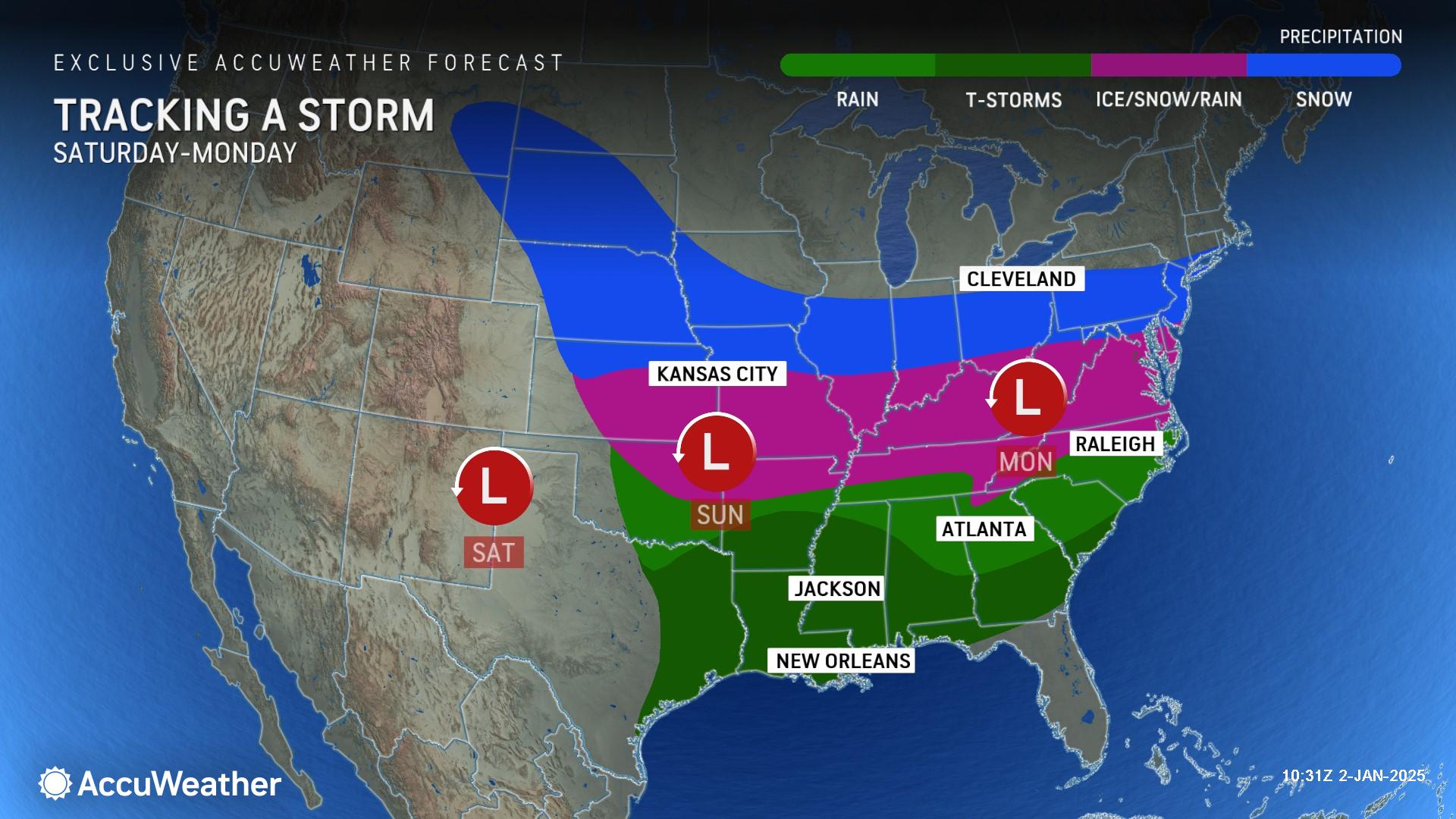
“A storm organizing off the West Coast will evolve into a winter storm with huge impacts for parts of the central and eastern U.S.,” Rayno said. “There is a risk of widespread power outages and major travel impacts.”
AccuWeather expert meteorologists say the storm could bring 3-6 inches of snowfall to a large swath of the region from western Nebraska to West Virginia.
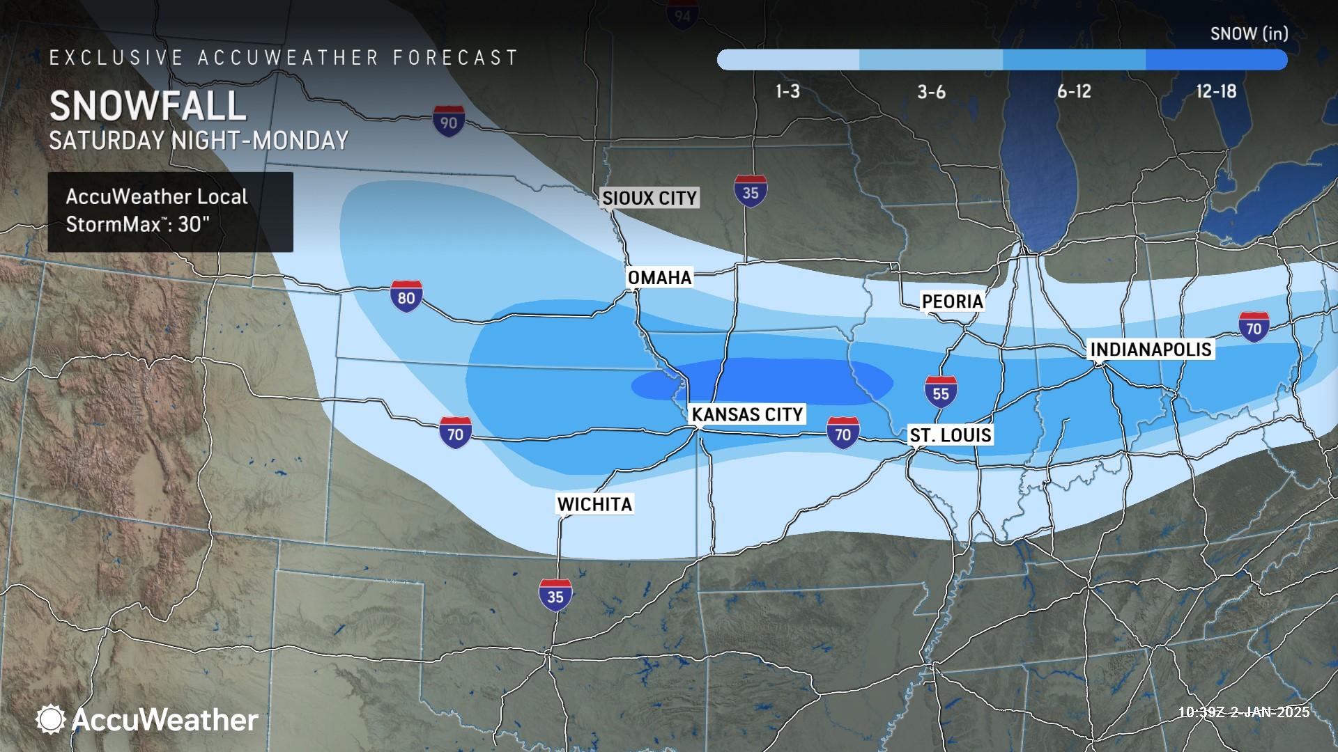
Pockets of 6-12 inches of snowfall or more are possible from northern Kansas and southeastern Nebraska to southern Ohio, with an AccuWeather Local StormMax™ of 30 inches.
An area of ice containing sleet and freezing rain will extend just to the south of the snow zone, from roughly I-40 to near I-70 from the Plains to the Ohio and Tennessee valleys.
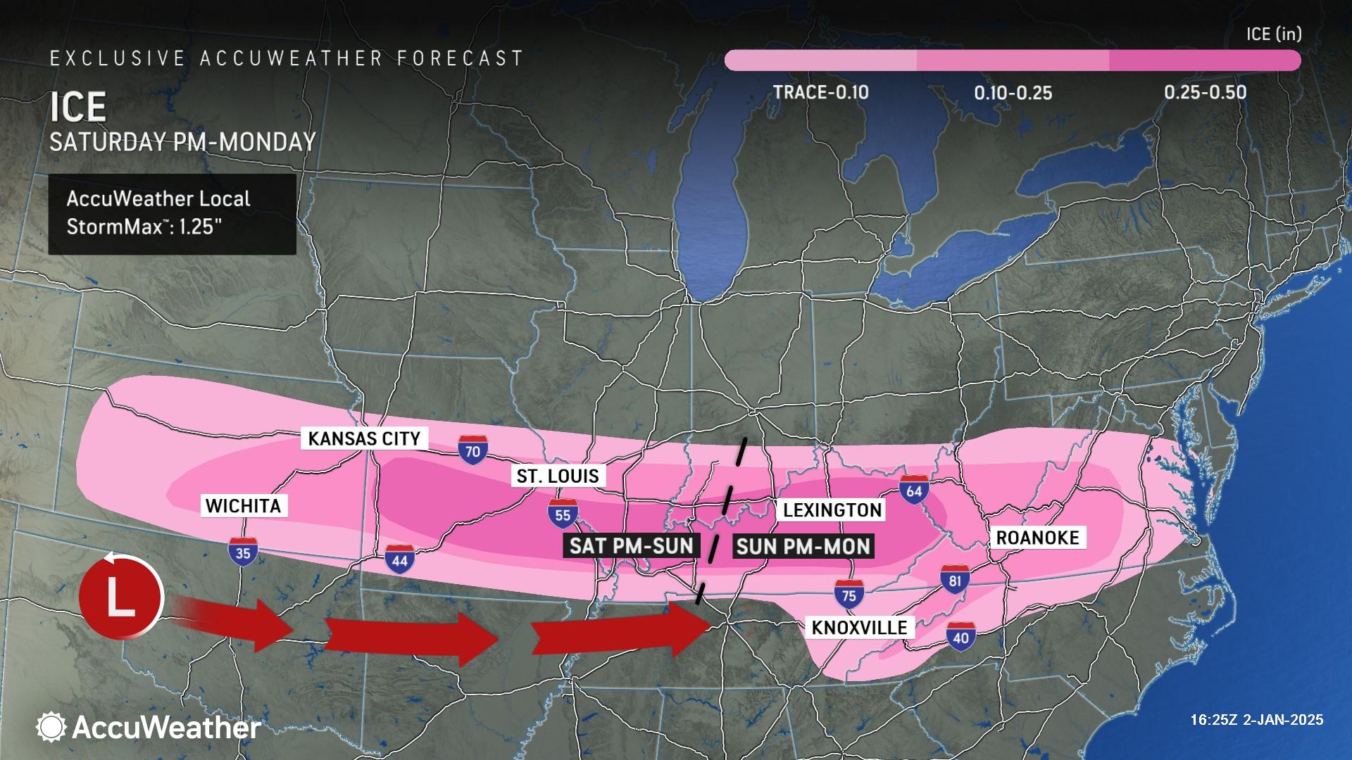
A destructive ice storm is possible from southeastern Kansas to southern Missouri, southern Illinois and southern and central Kentucky. A quarter inch of ice or more could bring down trees and power lines that can block roads. The power could be out for days in some communities, as dangerously cold air invades in the wake of the storm. Emergency shelters may be needed in the event of widespread and extended power outages.
“We’re concerned about the potential for significant ice from southern Missouri, Illinois and Indiana through central Kentucky. Ice could weigh down tree limbs and power lines. Families and businesses in this region need to be prepared for power outages, which could last for days in the bitter cold,” Rayno said.
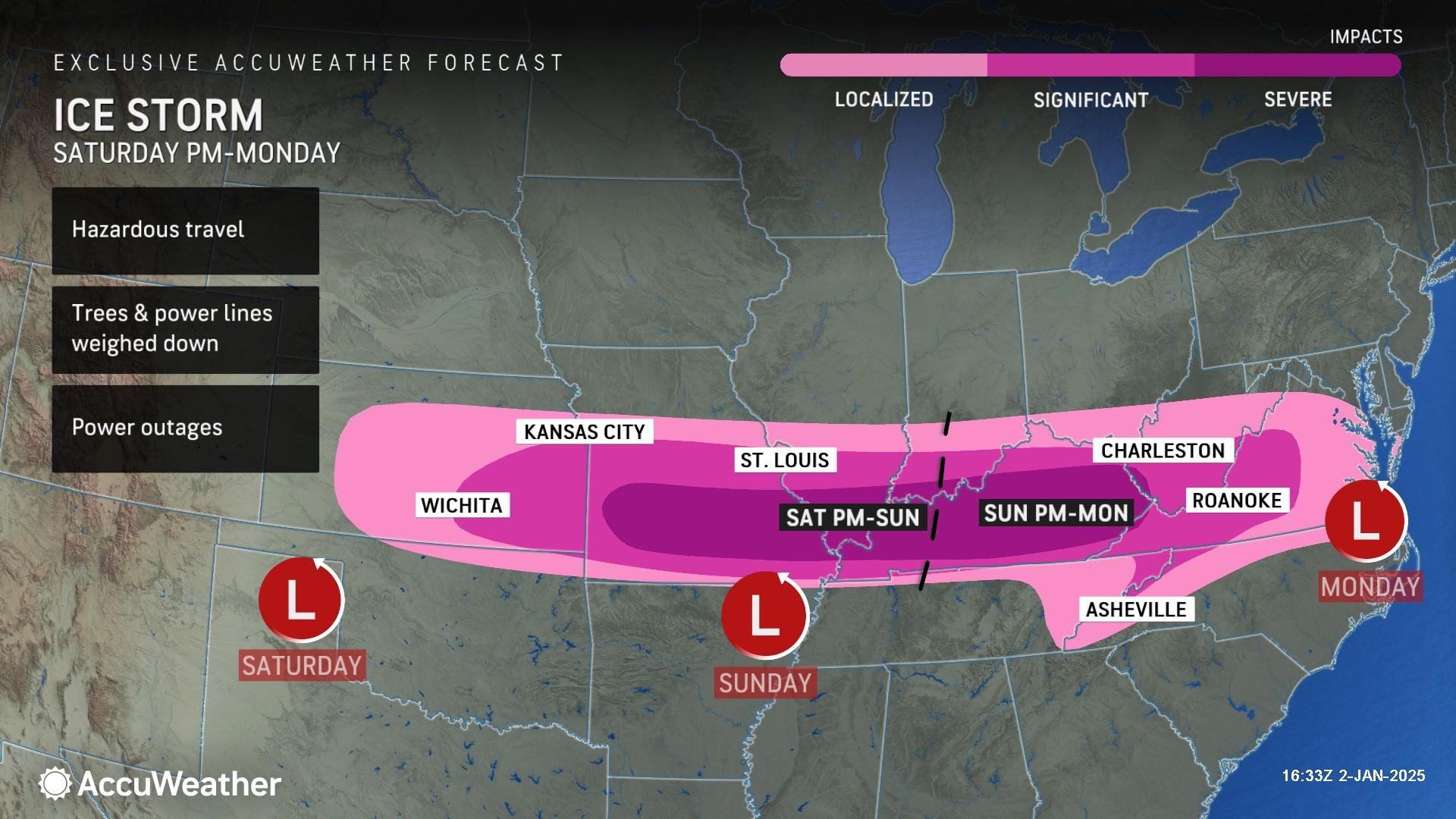
The icy zone may extend across portions of North Carolina, eastern Tennessee and the southern parts of Virginia.
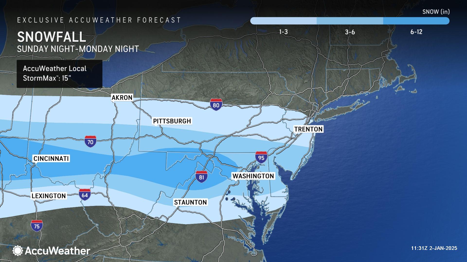
As the winter storm reaches the Appalachians and the Atlantic coast, the area that could receive accumulating snow from the storm will extend from near I-68 to near I-80. Major travel hubs in the Northeast are included in this zone, including New York City, Philadelphia, Pittsburgh and Baltimore.
AccuWeather expert meteorologists say this storm’s track and impacts depend on a separate storm over southeastern Canada, which could force the winter storm in the U.S. farther south.
A more southern storm track could mean dry conditions in New York City and Philadelphia, snow for Raleigh, Richmond and Washington, D.C., and ice or a wintry mix for Atlanta and Charlotte and Greenville, South Carolina.
This winter storm is expected to be potent enough to trigger severe thunderstorms south of the track, along the I-10 and I-20 corridors in the Gulf Coast states.
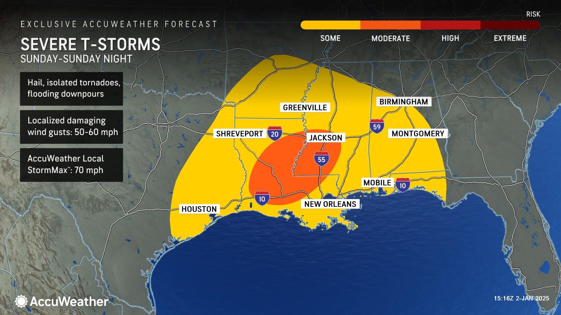
AccuWeather expert meteorologists say there is a risk of hail, flooding downpours, isolated tornadoes and damaging wind gusts of 50-60 mph on Sunday. The AccuWeather Local StormMax™ is 70 mph.
“These storms could spin up a few tornadoes in areas that have already been hit hard by severe weather over the holidays,” Rayno said.
Additional winter storms may follow in the wake of this cross-country storm, including a storm that could send snow and ice toward the Gulf Coast states.
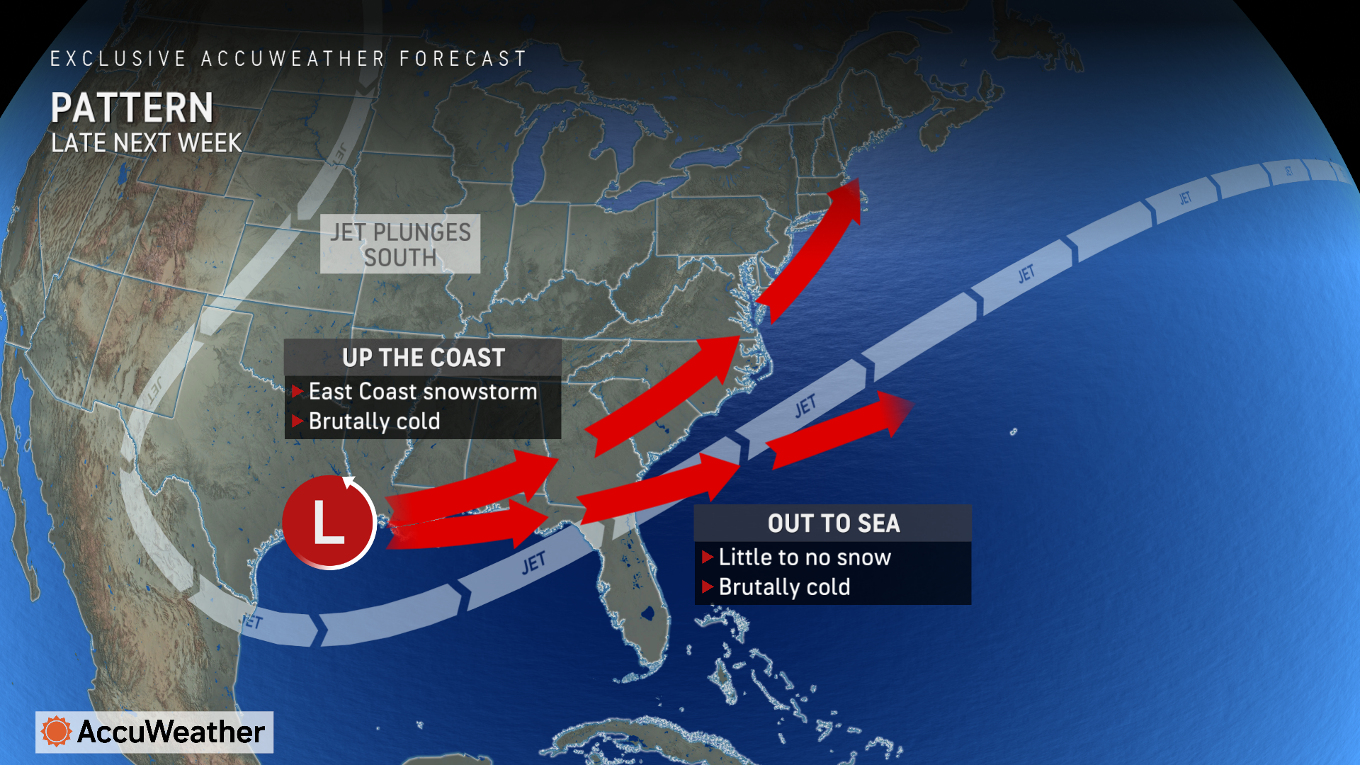
AccuWeather expert meteorologists are closely monitoring the potential for a storm later next week that could begin near the Gulf and travel north with snow and ice impacts along the Atlantic coast.
Outbreak of Arctic air
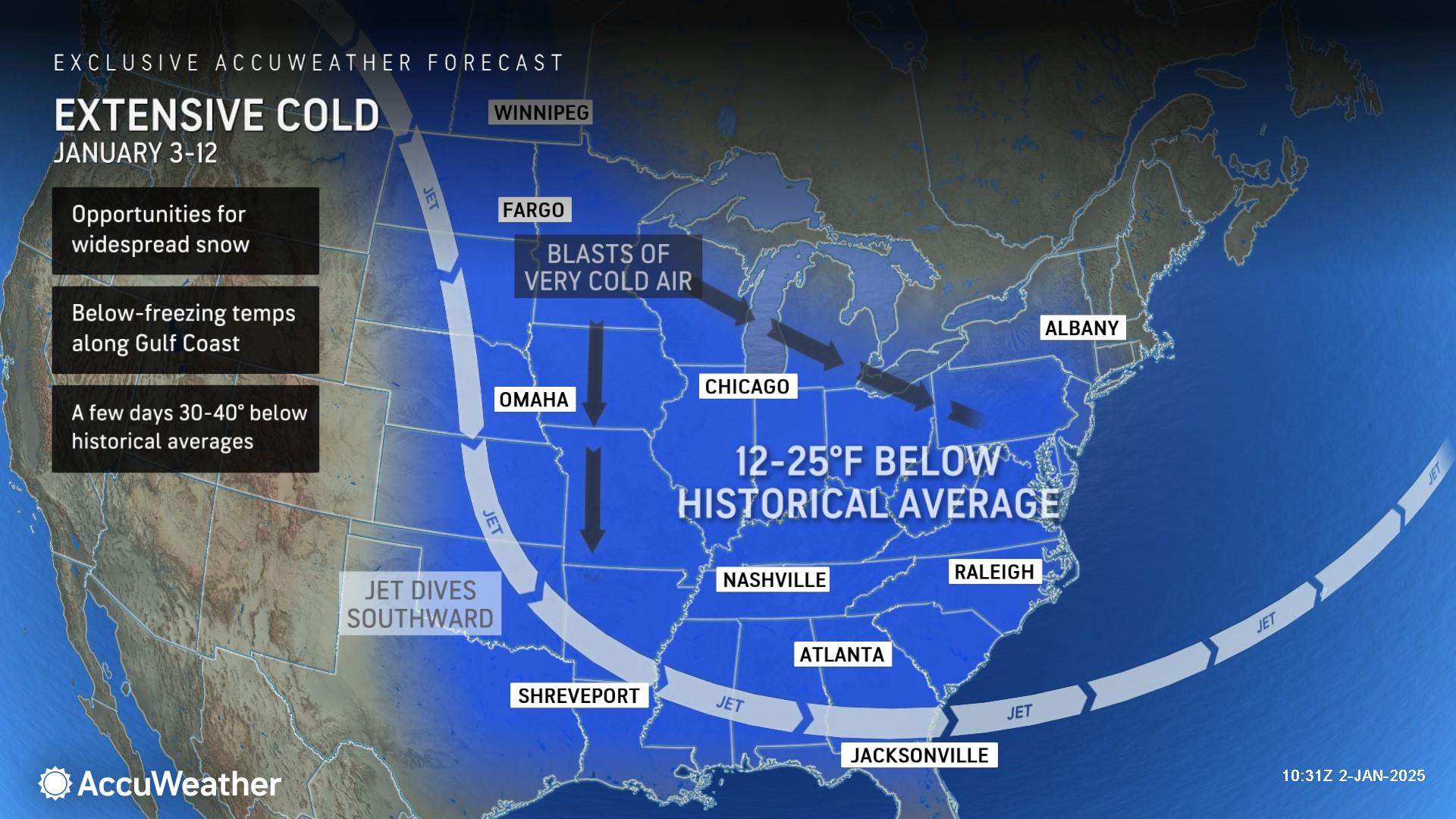
Back-to-back waves of bitterly cold, Arctic air will plunge into the central and eastern United States. AccuWeather expert meteorologists say each wave has the potential to bring colder air farther south than the previous Arctic blast through next weekend.
The frigid temperatures will likely trigger a surge in heating demand across the eastern half of the United States. The bitterly cold air could also impact natural gas drilling and operations in the Marcellus Shale region of the Northeast.
The magnitude and extent of the Arctic air will build into the first full week of January and linger through the middle of the month. At times, the bitterly cold air will affect more than 250 million people living in more than 40 states in the Central and Eastern regions.
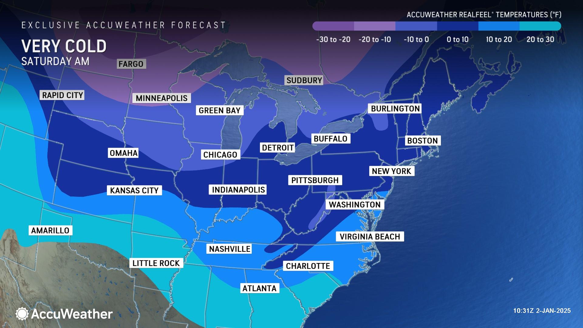
AccuWeather expert meteorologists say the cold air may fall short of plunging to the most extreme conditions seen in the past 10-15 years, but the length of the frigid conditions could lead to this January being the coldest January in the United States since 2011.
“The combination of lingering neutral sea surface temperatures in the tropical Pacific, warm water in the northern Pacific and an atmospheric traffic jam will induce multiple rounds of Arctic air east of the Rockies,” AccuWeather Long-Range Meteorologist Alex Duffus added. “The pattern creates a persistent southward lunge in the jet stream in eastern North America to allow the frigid air to empty out of the Arctic and into the central and eastern U.S.”
In the Southern states, exposed or poorly insulated homes and buildings are at high risk of frozen and bursting pipes with the potential for major water damage. The persistence and magnitude of the cold can be enough to cause heat pump systems to struggle to keep up. As energy demands increase, the strain on the electric grid could lead to power conservation requests and potentially blackouts.
Crops sensitive to the cold could be at risk of damage in Gulf Coast states due to the magnitude and duration of freezing temperatures. Subzero RealFeel® temperatures are expected to reach east of the Appalachians and into the Gulf Coast region late next week.
Ice cover on the Great Lakes is currently well below the historical average. Blasts of bitterly cold, Arctic air over the relatively warm waters of the Great Lakes can lead to heavy or extreme bands of lake-effect snow, which could bury towns in feet of fresh snow this week.
AccuWeather expert meteorologists are forecasting several zones of 6-12 inches of snow in Michigan, Ohio, Pennsylvania and New York through Sunday. Pockets of 12-24 inches of snow are possible downwind of the Great Lakes in parts of Ohio, Pennsylvania and New York, with an AccuWeather Local Storm StormMax™ of 48 inches.
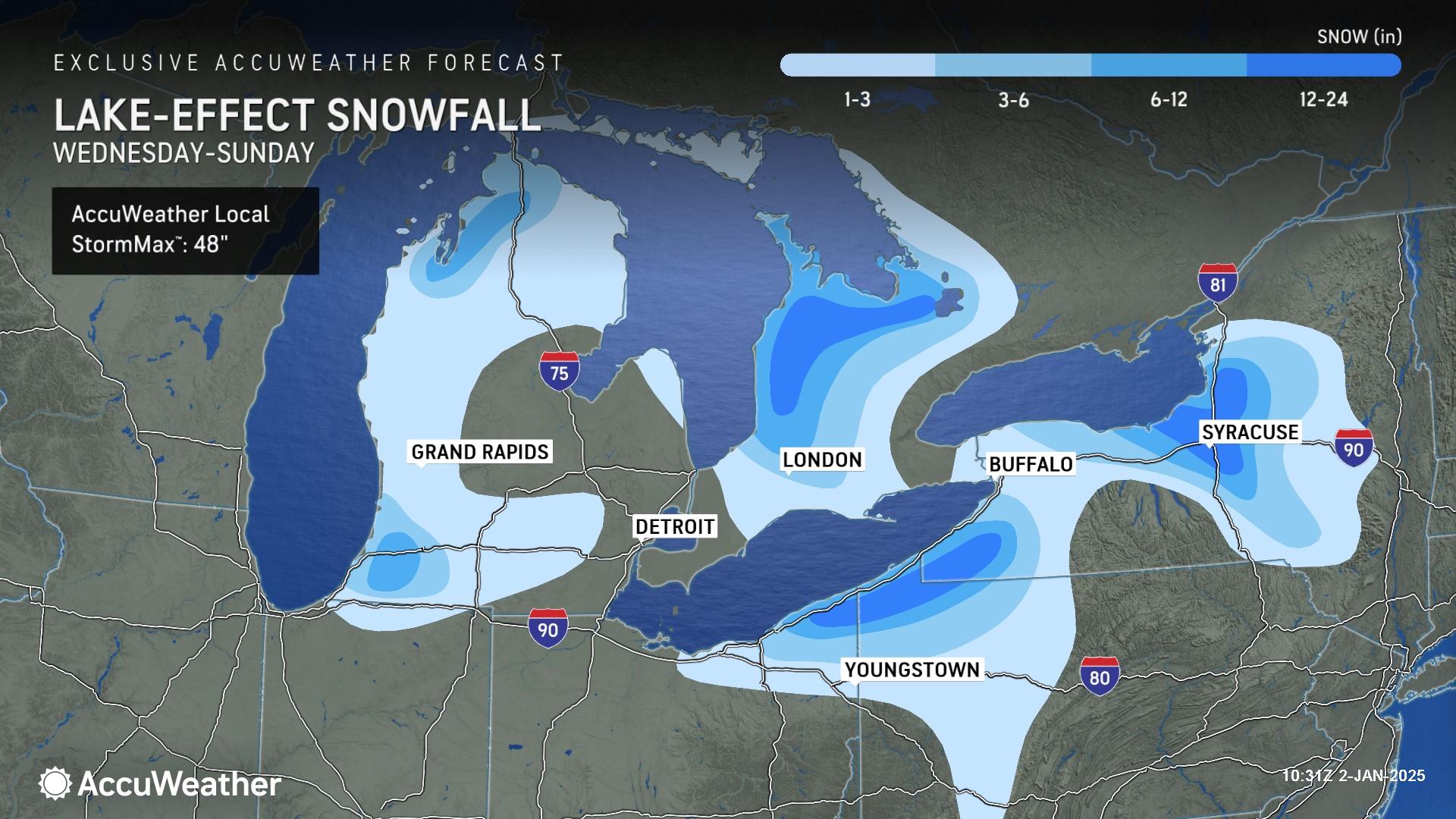
Persistent cold air will cause the ice cover to increase substantially. As the ice coverage increases, the warming effects of the Great Lakes will be reduced, opening up the Northeast to more exposure to extreme cold.